By Jenna Berting, Friends member from Washington State
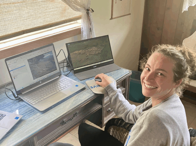
The walrus monitoring project gave me a chance to use my skills to help wildlife even though I was working remotely in Hawaii at the time! I heard about the opportunity on the Friends website and applied and volunteered with the Togiak National Wildlife Refuge to assist in a research project monitoring Pacific walrus populations. I volunteered 23 hours over the course of a month, working remotely, to help count walruses captured by remote game cameras stationed at five different haul-out locations within the refuge. This monitoring plays a critical role in understanding walrus behavior, population dynamics, and environmental impacts on these marine mammals.
I collaborated closely with Jannelle, a wildlife biologist at the refuge, who guided the process and served as a supportive and knowledgeable mentor throughout the project. Working with Jannelle was the highlight of the project – the encouragement and willingness to assist made this not only a learning experience but a truly enjoyable one.
We used QGIS, a geographic information system tool, to overlay various data layers that supported visual analysis and improved accuracy in our counts. In many instances, we reviewed side-by-side images from dual-camera setups to match and align photographs before finalizing the counts.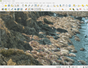
Walrus at Bird Rock haulout, Togiak Refuge. I applied the dots as I identified each walrus and the QGIS program tabulated them. Pc USFWS
Walrus counting was occasionally visually challenging due to factors such as lighting conditions (e.g., sunset or overcast skies), weather interference, and the sheer density of walruses in the images—sometimes stacked on top of one another or spread out across vast distances. Despite these difficulties, I thoroughly enjoyed the process and learned so much.
This experience expanded my knowledge of walrus behavior, particularly their haul-out patterns, social groupings, and how tightly they cluster in large groups along the shoreline. I gained valuable skills in remote data analysis, wildlife monitoring techniques, and spatial mapping using QGIS tools. I look forward to supporting similar conservation initiatives in the future!